Day 10 – Landslide blocked our way

IMG_6162
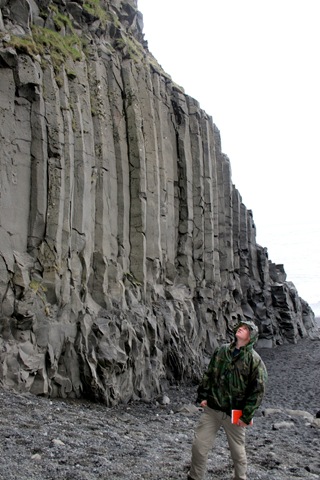
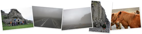
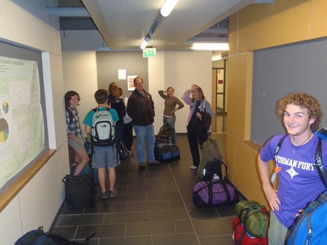
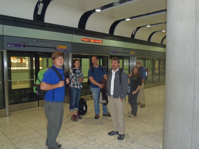
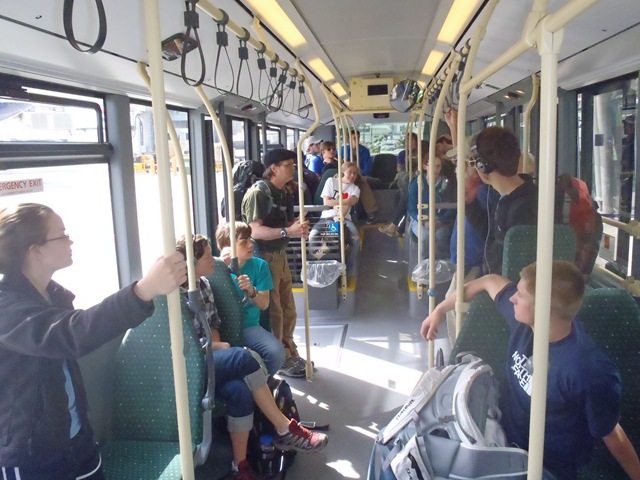
We left Hvoll hostel at 8 AM and headed to our next hostel destination, which is Borgarnes, a small city located along the western fjords.  Students were very interested in the Wool Factory located in Vik, so, we made a stop there.  We also had to pick up few items that were left behind at the hostel in Vik (photo on left) where we stayed last.  Our guide Sveinborg accompanied us until the wool factory and parted her way to Reykjavik.   

IMG_6309
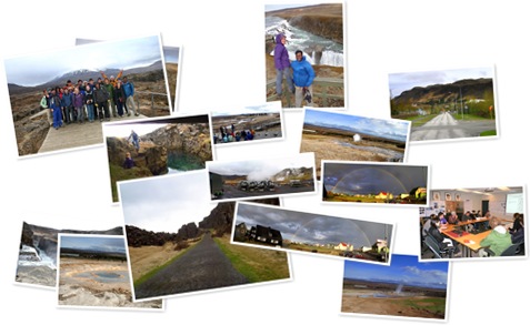
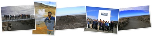
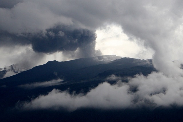
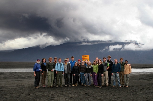
We talked our driver into driving us closer to the erupting volcano in order to get a closer view of eruption.  So he took us as far as the bus could go, which in this case was where the road ends on a river bed.  To go beyond, we needed special vehicles that can be driven through several miles of broad and soft river bed.  The view of the eruption was really good.  We took lots of pictures, and collected some ash samples.  Luckily, it started getting cloudy and covered the view of the eruption completely just about the time we were leaving.  We really were lucky to be there at the right time to use the short window of opportunity!

IMG_6246

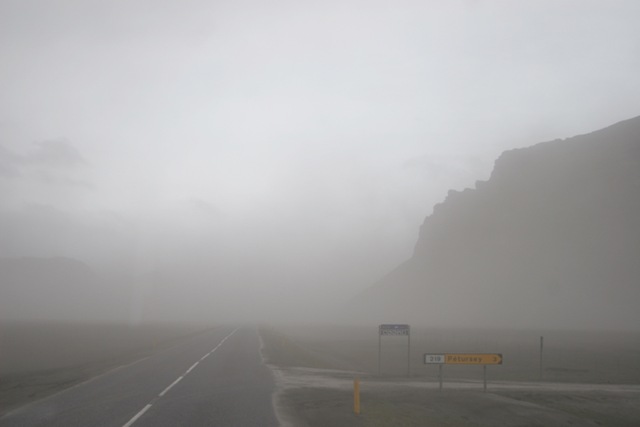
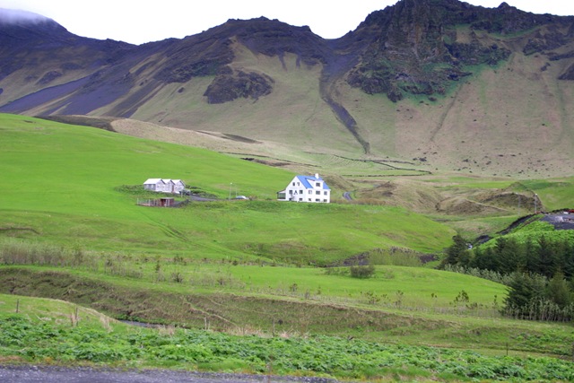
We stopped for lunch at a gas station (fast food, but much better quality than we have in the United States) and continued our journey across Iceland to the western peninsula.  Most of us had opportunity to take short naps through the scenic journey.  We took country side roads through Thingvillier National Park, where it started become very mountainous.  I believe the driver chose to take this route (which is usually closed until summer time) because it is very scenic and has lots of cool geology.  However, when we were about 40 minutes away from our destination, we encountered a debris slide that has come down all the way from atop the slope of the mountains and ran over the road.  P5210430 
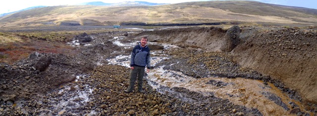
It was pretty wide at the point it intersected the road (more than 100 feet) and it appeared to have happened overnight during heavy rain, so it still had lots of mud and debris that were unstable.  This meant, we had to turn around and drive back through different road, which added about an hour and half to our journey.  It was nothing to complain about, but just another great opportunity for us and our students to see the geological forces at work.

IMG_6371 We reached the Borgarnes hostel and got checked in.  There was a Pilipino restaurant and bar in town that was highly recommended for us.  We called in and requested them to serve us a buffet, which they agreed to happily.  We enjoyed the food and went to bed, while most of the students went to participate in a local meeting that was related to upcoming election in town.  They said there were live bands after the meeting, and got to interact with college age local folks.  The one thing that was missing in this trip (interaction with locals) so far was rectified at this place.  Both our students and the Icelandic folks really meeting each other.

Day 7 – Ash and Waterfalls day

IMG_5794

IMG_5778 We left Vestmanayer Island at 8.15 AM and reached mainland at 11.15 sharp.  Our bus was waiting for us with a new driver.  Our goal was to drive to our next hostel in Vik and see any geologic features along the drive.  Our new drive seem to have good idea as to what the stops were going to be, so we went along.  We ate lunch at a burger shop, and I learnt that hotdogs here are made of lamb meat, and they are delicious.IMG_5679

We visited two different water falls (Selizalandsfoss and Skogafoss) both of which are fed by glacial melt water from the highlands, visited a man-made cave, sea cliffs and sea arch/cave.  It was pretty windy, cold, drizzling, and the sea was very rough.  We braved it all to look at the beautiful columnar basalts, and highly fractured basalt.  We were not able to go see the cave because the tide was high and had cut off the beach at the promontory.  As we were driving, we also came across zones where the volcanic ash was blowing over making it very hard to see anything.  At times, the visibility was reduced to just about 10-20 feet.  IMG_5705We also got to see Icelandic Horses in a small horse farm house.  They are so beautiful.  

Finally we reached our hostel in Vik, and what a beautiful location it was.  Got to see the photos to understand!


Day 6 – Himay Island

View Larger Map

We planned to walk to the northern shores of the Island around the harbor and hike to the top of the Heimaklettur (283m amsl) mountain followed by walk to the south eastern shores of the island where there was supposed to be a lot of pumice washed up from the eruption on mainland.  We started at 9.30 AM, packed sandwiches for us, and eventually walked to the north shore.  From distance, it appeared like it would be impossible to hike to the top of the hill because it had vertical cliff all around it that was at least about 40m tall.  As we got closer, we saw nearly vertical ladders that were chained to the rocks that provided access way.  It was a good hike to the top and not as strenuous as we imagined it would be.  The view from the top was unbelievable and it was also clear blue sky day, lucky us!  As we sat down with our sandwiches, we witnessed the most beautiful ash plume rising above the clouds that were hovering over the ice-sheet where the erupting volcano is located.  We were completely mesmerized with the view and kept watching it as it rose higher and higher and higher.  The high-altitude wind was blowing towards east or south east, so it provided an unobstructed view of the whole ash cloud for us (we were viewing from southwest direction).

The view of the 1973 eruption from the top was awesome.  One can see dark colored lava fields that had no vegetation covering a large part some too close to the line of houses and the harbor entrance.  We learnt that the 1993 lava indeed engulfed some of the houses in that area and that people used sea water to solidify the advancing lava near harbor entrance to stop it from closing off the harbor.  They needed to pump so much water that they imported large capacity pumps from the US and used it here.  The current population of this Island is about 4000. 

After spending an hour or two on top, we climbed down, walked along the shore to different places.  Near the entrance to the harbor, we saw some of the pumice (really light volcanic ash clumps, that float in water) washed ashore and collected them.  It was close to 5pm, so we headed back to the hostel.  A small group went and hiked to the top of Eldfell crater (221m amsl) after dinner.  Tomorrow we have to leave at 7.30 am to catch the ferry back to Þorlákshöfn and take a bus to Vik.  We are hoping to find a place to get closer to the volcano.  We will have a geologist guiding us for the next two days. It should be exciting.

More tomorrow…

Day 5 – Vestmanayer Island – the 1973 Eruption site.

We left our Reykjavik hostel at 9 AM and headed toward a small fishing town called Þorlákshöfn located southeast of Reykjavik.  Our driver Thor suggested that we see an exciting site that has red lava layers, so we decided to make a stop there on our way to the Ferry Dock.  That happened to be an exciting site for us – it had really reddish (oxidized or compositional?) and dark grayish lava layers that could have been very well a part of an older eruption cones.  We spent an hour there (Jack couldn’t get enough of it though) and decided we need to leave to catch the ferry.  This site had one of the best display of volcanic bombs and ribbon flow structures that are usually associated with strombolian type volcanic eruption.  Most of us collected some specimen for our desk or mantle or for friends.  We left the town and drove to Þorlákshöfn, which took about 35 minutes.  We reached there with more than an hour of time left for the ferry, which was being washed (of the ash from eruption) at that time. So we stopped at the local gas station and grabbed some snacks and coffee.  We had a surprise birthday party for Brannon Andersen, and as per our request our travel agent in Iceland came there with a large chocolate cake.  Brannon and others enjoyed the cake.

The ferry was pretty large (unlike the ones I have been on in Galapagos) and had many levels with sleeper classes, restaurant, movie theaters etc.,.  It was about three hour ride to Himay Island, which is the largest of the 15 Islands making up this archipelago.  The most recently formed Island in this chain is Surtsey, which formed in 1963 through an eruption that lasted for nearly 4 years.  This was initially an under water volcano (130 m below sea level) that erupted enough material to build up an Island above water.  It is not open for general visitors so we were not able to go there.  They are carrying out research on the Island and only people involved in research projects are permitted currently. 

The captain of the ferry was nice enough to let few of us on to the control deck in the front and we got to speak to the captain and the first seamen.  They both gave lots of information about life in general to the active volcano, life on ship, 9-10 meter waves that make every one on the ship sick etc.,  It happened to be a day with calm ocean, so none of us had any problem.  The view was amazing.  The Eyjafjallajökull volcano was not visible due to large cloud cover over that area.

Once we landed on the Island, we walked over to meet with a Geologist who works on the Island to get a overview of the geology.  It was a very sleepy hour for most of us, and some how we managed to stay awake through the talk and surprisingly retained some of the things he showed and talked about.  After that we walked (dragging our baggage with us) through streets filled with about half an inch of fine volcanic ash that was getting blown by occasional gusts of wind.  It was incredible to see that much of ash coming over just two days of wind blowing toward this Island from the erupting volcano.  We only can imagine how much ash there is in Vik, which is downwind direction from the volcano, and where we will go to next in two days.

After settling in the Hostel, which happened to be very nice (probably recently renovated house) we went for dinner at the Fjolan Restaurant that was adjacent to the hotel.  Food was delicious and very expensive!  As a Birthday gift to Brannon, I and Jack took him on a late night hike to one of 1973 eruption cone, which was about 200 m tall.  It was a great hike and we were surprised to find out about it being geothermally hot on top.  Some one at the restaurant said it was not like that before, and it started radiating heat only recently.  We never know what we are going to see in the future here.  The recent eruption is A’a’ type, which is very blocky, sharp, and difficult to walk compared to Pahoe-hoe type, which is smooth flowing type.  We are excited about tomorrow, and can’t wait to hike to the top of the highest volcanic hill on Himay Island.  It should give us a great view of Eyjafjallajökull volcano also.

Good night!

Day 4 – Exploring Reykjavik City

We started the day with the goal of walking the shoreline and studying some spectacular inter-bedded sedimentary and volcanic sequences that were supposed to along the western shoreline.  We walked couple of kilometers all the way to the end where there was a Ferry launch area.  We found an interesting outcrop and spent a couple of hours there.  We then took a long walk back towards downtown Reykjavik and to our surprise, there were lots and lots of people along the main street – very much reminded us of Greenville main street in character.  Lots of restaurants, lots of high-end garment shops and many touristy places.  Walking is in the culture of Icelandic people, but lately American and Japanese cars are invading the lives of Icelanders and some one pointed out that there are nearly 2 cars for each household here. 

We walked back all the way to the hostel.  It was many miles worth of walk for the day but none of us minded it.  Of course we were beat completely when we got to bed.  Tomorrow we will be visiting some of the coolest places in Iceland – listed in top 10 places to visit in most books.  We are all excited.

Look back tomorrow for more.

Day 3: Geyser and Waterfall – Best day so far!

We started our day at 8 AM, and visited Icelandic Meteorological Office who is the main governmental body that oversees weather, climate, seismological, and GPS network in Iceland.  We learnt about the current status of scientific observations and monitoring that is going on with respect to the erupting volcano in southern Iceland.  After that, Thorleifur took us to "the pearl" building (Oskjuhlid) that has a unique architecture and shape to the building.  This building is located on top of a small hill and houses the hot water storage reservoirs and distributes it through pipeline by gravity (without the need for pumping) for the city of Reykjavik.  Hot water is piped in from more than 60 km distance where geothermal fields are located.  We did a little grocery shopping for lunch, and realized it was as expensive as having a full meal for the group!  Everything is expensive here.

Our first field stop was at Hellisheidi Geothermal Power Station located in Orkuveita.  This is a really cool facility that generates currently generates about 213 MW of electricity.  In comparison, whole of Reykjavik city (population of about 150,000 or half of Iceland) only needs about 200 MW of electricity.  This is not the only geothermal power plant in Iceland!  We were (not so?) surprised to learn that it cost IKR 10 per KW of electricity and IKR 80 per cubic meter of hot water (currently, $1 = IKR 128). This power plant is very advanced and so they don’t have any waste water lagoon like some of the other ones.  Most of the waste water is captured and reused or injected back in to the ground.  They are also working on a plan to separate all CO2 from steam, dissolve it in water and pump it back into the ground to reduce natural CO2 emission that comes as part of exploiting geothermal solution. Second stop was at a small town named Hverangerdi for students to exchange currency. One of the restaurants in this town uses geothermal heat to cook and bake goods.  It was an amazing site to see the chef coming with a bag full of potatoes and dumping in to hot and steamy water outside the restaurant. 

Our next stop was to Þingvellir (Thingvellir) National Park located in the southwestern Iceland.  This place is very important to Icelanders historically because this is where they had their parliament was established way back in 1930.  Read more interesting information about this park’s history here.  Geologically, this site is located in the middle of the rift zone, so it displays the rift valleys and faults with large displacements clearly.  One of the faults run for more than 10 miles and is about 20m wall high cliff. There is a large freshwater lake, which is likely the largest freshwater lake in Iceland, located at this park.  One of the other coolest thing at this site is Nikulásargjá, which is a rift-fracture with clear, transparent and very deep water with tons of coins thrown in by the visitors.  Some of the students tried to put their hand to grab some coins but water was freezing cold, so just managed to pick some coins that were stuck along the shores.  The major river that feeds into the lake here is called Öxará.  Our guide, a historian, said the name is based on the legend that in ancient times, men and women were punished for their crimes at this site – men were beheaded and women were drowned in the cold waterfall called Öxarárfoss.  We had lunch at a picnic shelter that was surrounded by older volcanic mountains, some of them had snow cover on top.  From there, we were able to see one of the coolest shield volcano (very low angled volcanic cone like the ones in Hawaii).

Third stop was at Iceland’s famous waterfall Gulfoss. This waterfall was really cool and even though was not the tallest in Iceland, it had unique step-falls feature, a total drop of little more than 100 feet.  The geology of the area aids in development of the waterfall here.  Over geologic time (we are talking about several millions of years), glacial sediments and lava flows of different periods built the terrain and with the glaciers melting, large volume of water goes through the area with intense faulting developed by the pulling apart of the continent through mid-ocean ridge (rift zone). The rivers find the fault zone to be a plane of weakness and take course through them.  Due to differences in the erosional potential of volcanic (harder) and sedimentary (easier) rocks, it creates a deep canyon here.  This waterfall is eroding at a rate of about 25m/year (I have to check this number though!).  This means, in four years, the location of waterfall would have moved 1 meter upstream from where it is. 

The last geological stop for the day was at “The Geyser”, that erupts at about 5-6 minute cycle.  As we were approaching the geyser site, we got to witness one of the largest eruption of the geyser from our bus.  We spent about an hour there witnessing several geyser eruptions, some of us getting splashed by the erupting geyser.  It’s amazing to see the pool of water slowly rocking back and forth until a huge amount of gases and super heated water travel through from the depth and bulging up to become an explosion.  Just cool!

Our guide then recommended that we visit a small coastal town called Eyrarbakki, his native town where his grand father was a fisherman long time ago, to see an exhibition at a historic house and visited the local museum.  We were treated with some traditional songs by a group of locals at the exhibition house.  We also saw an amazing full rainbow as the sun went down in the late evening.  One of the best evenings.

Second day – Field day!

Today we had a guide from the Icelandic GeoSurvey, Draninn Fredriksonn, who took us around to different sites of geologic interest in the Reykjanes Peninsula. Our first site was “Bridge between the two Continents”, which was basically a rift zone that has several en-echelon faults that are part of the Reykjanes Rift Zone. Even though this site is not literally representing the center of the active rift zone that separates North American continent from Eurasian continent, it was really nice to see the what a rift zone looks like. We noticed a lot of aeolian black sand (with shell fragments blown from the ocean by wind) deposits at the grabbens and the basaltic rocks had large vesicles and some alveolar weathering features. Students enjoyed jumping from the top of the basaltic flow to the soft sand below.

Icealnd-Day-2

(Click on the image to see larger version)

We then visited two recent volcanic cinder cone craters, that erupted in 1300’s. They had very light weight scoria (as light as pumice stone) and showed beautiful ropy, pahoe-hoe lava structure. We walked on the lava field, explored the spatter cone, discussed the composition and origin of layering on the rim of the cones. We also noticed lava tube in several places.

From there, we drove a short distance to the lighthouse and studied pillow basalts (indicating under water volcanic eruption) along the shoreline, then walked north from there along the shoreline observing shoreline changes, basaltic dykes, and a really nice stratified volcanic ash deposit that formed several meters high cliff along the shore.

By this time, we were getting hungry (it was about 2pm), so drove to the nearby Grindavik town and had a good fast food lunch. It was much better than any other fast food we have in the US. After eating, we drove to the most popular “Blue Lagoon”, which is a hot spa, naturally heated outdoor pool. Apparently the hydrothermal power plants produces a lot of waste water (water that is left after separating the steam to generate electricity) that is very rich in minerals, particularly silica. This water is pooled outside the power plant, and as it cools silica precipitates as a fine sludge giving the beautiful blue color. It’s incredible beautiful, and what a way to make money of a waste product.

The final stop for the was at the geothermal field in Krysuvik-Seltus. We saw some boiling mud and hot and steamy springs. Most of them were at or above boiling temperature and very acidic and had a strong hydrogen-sulfide smell (like rotten egg!). It was really cool to see the boiling water coming out of the ground and flowing down as a stream. What a great site – this was just one of many that are in the area. Several hydrothermal power plants are located in the region. We will be visiting one of them tomorrow. This is it for now.  Please visit the album below to see a few sample photos.

Iceland: Land of Fire and Ice

We planned this for over a year and made all the arrangements, and called our program “Iceland: Land of Fire andP5100046 Ice”, at that time, it was just a name.  We knew the Ice part was real but the fire part was just history.  But now it is real – there is an active volcano and this program is essentially about Fire and Ice.   P5110051

After all the delays related to the ash plume and nearly  abandoning this program, we miraculously made it through a long and tiring journey to Iceland.  I really have to tell about how we got here.  We drive to Charlotte in two vans (thanks to Bill for driving us) and were separated into three groups to take three different flights to New York.  First two groups were fortunate to get a direct flight but the third group (of which I was part of) had to go through Boston to get to New York.  We certainly enjoyed the strange and unusual hospitality shown by JetBlue crew in the flight to Boston (it was their 10th anniversary!); it was not the same case in the second flight.  Once we all grouped together at JFK, we got on a British Airways flight to London Heathrow, from where we took an Icelandic Air flight to Reykjavik.  The pain of long journey, less sleep, tiredness, etc., are now in the background, and excitement of beating the odds and getting here to Iceland took over.  We just couldn’t control our happiness.

P5110060

Here students are waiting at the NY-JFK airport for our flight to London.

P5120065P5120067

Left one – we are waiting for the transit train to go from arriving terminal to Icelandair terminal in London. Then a long bus ride took us to the gate.  It is mid-night here, and I will post more tomorrow.  Look for the snapshot of the erupting volcano taken from our flight.  Hopefully we will get a close-up shot some time in the next week.

View May 2010 – Iceland in a larger map

The map above shows where we are staying for the first few days.  Notice a nice hot-pool, a geothermal swimming pool, right next to our hostel.  Look for us there tomorrow!  🙂

The sun set was at 11 PM, and sunrises at 3 AM here.  Drives me nuts to go to bed with daylight.  Long days are good for us – more to see.  We are 4 hours ahead of east coast time.

Good night for now.