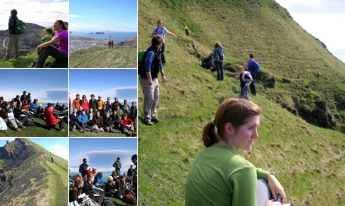
We planned to walk to the northern shores of the Island around the harbor and hike to the top of the Heimaklettur (283m amsl) mountain followed by walk to the south eastern shores of the island where there was supposed to be a lot of pumice washed up from the eruption on mainland. We started at 9.30 AM, packed sandwiches for us, and eventually walked to the north shore. From distance, it appeared like it would be impossible to hike to the top of the hill because it had vertical cliff all around it that was at least about 40m tall. As we got closer, we saw nearly vertical ladders that were chained to the rocks that provided access way. It was a good hike to the top and not as strenuous as we imagined it would be. The view from the top was unbelievable and it was also clear blue sky day, lucky us! As we sat down with our sandwiches, we witnessed the most beautiful ash plume rising above the clouds that were hovering over the ice-sheet where the erupting volcano is located. We were completely mesmerized with the view and kept watching it as it rose higher and higher and higher. The high-altitude wind was blowing towards east or south east, so it provided an unobstructed view of the whole ash cloud for us (we were viewing from southwest direction).
The view of the 1973 eruption from the top was awesome. One can see dark colored lava fields that had no vegetation covering a large part some too close to the line of houses and the harbor entrance. We learnt that the 1993 lava indeed engulfed some of the houses in that area and that people used sea water to solidify the advancing lava near harbor entrance to stop it from closing off the harbor. They needed to pump so much water that they imported large capacity pumps from the US and used it here. The current population of this Island is about 4000.
After spending an hour or two on top, we climbed down, walked along the shore to different places. Near the entrance to the harbor, we saw some of the pumice (really light volcanic ash clumps, that float in water) washed ashore and collected them. It was close to 5pm, so we headed back to the hostel. A small group went and hiked to the top of Eldfell crater (221m amsl) after dinner. Tomorrow we have to leave at 7.30 am to catch the ferry back to Þorlákshöfn and take a bus to Vik. We are hoping to find a place to get closer to the volcano. We will have a geologist guiding us for the next two days. It should be exciting.
More tomorrow…
