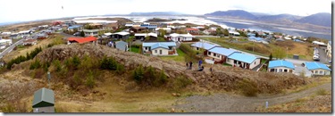
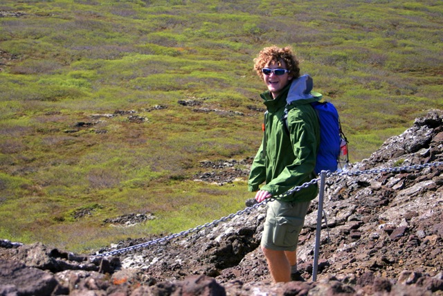
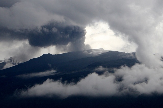
 We started off the day at 8.30 AM and had few exciting stops to make. Our driver suggested we climb on top of the water tower that is located on a small hill to get a overview of the entire town. The water tower was designed to provide such access to the tourists – with a staircase leading to the top, and there was a sun clock. I wish we could use water towers in our towns this way – with most of them so tall, it would be an amazing view. I can’t imagine that happening in the US any time. From the water tower, we were able to view the tidal inlet, which in this case was a deep valley left behind by the glacier that got flooded by ocean (technically this is called a Fjord), we got to see a lot of glacial features like Roche moutonnée, arêtes, horns, and cirques. We discussed how some of these features can be used to identify the direction in which the glacier was moving.
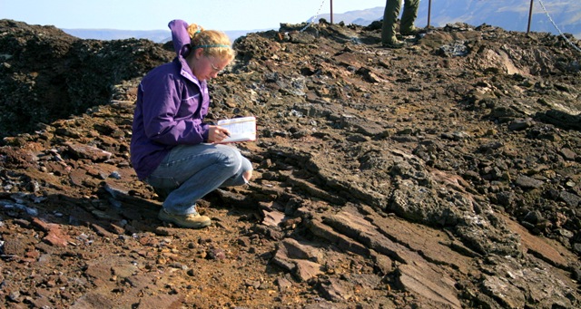
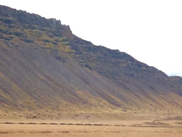
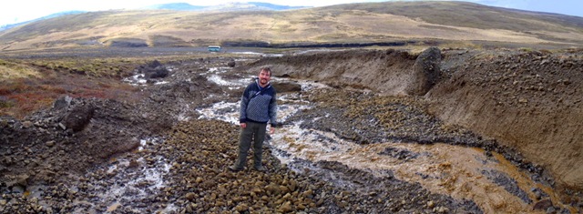
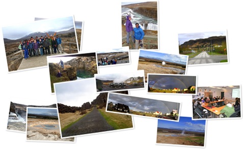
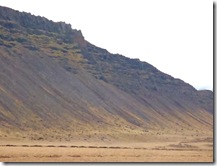 As we were driving, we saw beautiful horizontal lava flows that make up most of the hills, and occasionally some dykes that cut across the layers. One of the dykes was protruding out of the hill and stood out like a wall. It was too high and too steep of a hill for us to climb, so we just made a roadside stop to take pictures. As we continued driving, we noticed there were broad stair-step structures on the landscape on either side of the valley. We believe these are wave-cut terraces indicating coastlines of the past during times of higher sea level. There were also a lot of geothermal fields that were visible.
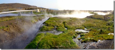
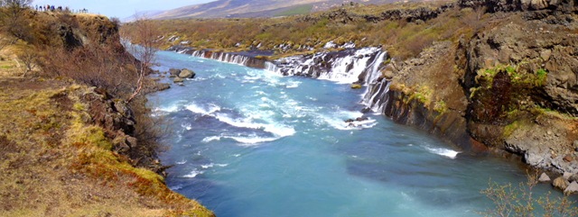
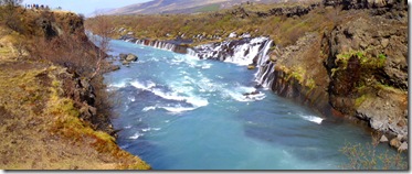 The next stop we made was really cool and really unique. This place is called Hraunfossar and Barnafoss (children’s falls). There were numerous springs that were exiting out from in between layers of basaltic flows all along the narrow canyon of the river Hvita. The glacial melt water from highlands enters highly fractured and jointed basaltic rocks and at depth encountered layer of lava with less permeability (ability of rocks to transmit water through them) which causes water to travel horizontally down slope rather than going further deeper into the ground. Eventually this water exits at the point where the river has cut a canyon, exposing that less permeable layer. What is amazing is, this is not a spring that we get to see in other places, barely visible flow – it has about 80 cubic meter per second. This location was also interesting in that it had a thick layer of well stratified sandstone in between basaltic layers, indicating a period when sand was deposited by the rivers flowing in the area and then covered by lava flow that came later. Good stop for paleo-environmental interpretations.
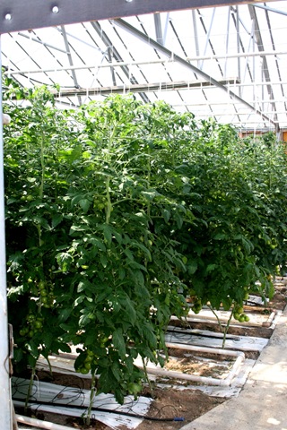
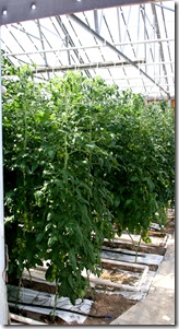 As we were driving through, we noticed there were lots of greenhouse farms in the area, and so decided to try our luck stopping at one of those farms to learn more about them. The farmer we met was very nice, though reluctant at first, he explained the whole process. This farm was particularly for tomatoes and had tomato plants that were taller than 7 feet. They were growing like a vine, but had a supporting string holding them from the top. The farmer said they plant tomatoes in February, and the first harvest starts in late April. These tomatoes produce until late November, and are harvested three days in a week. The yield was about 38 kg per square meter of the farm. We were surprised to learn that the seeds and special fertilizers are imported from Holland. They analyze the chemistry of the soil and water and identify the nutrients that are lacking, so that they can develop fertilizer that is just perfect for tomatoes for this particular farm. Tomatoes are harvested when they are still green and sent to Reykjavik where it is stored at 14 deg C for four days to turn them to deep red color before selling them at markets.
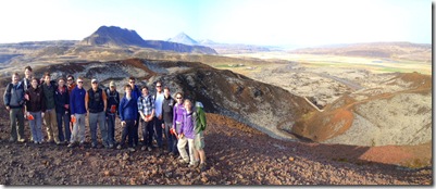
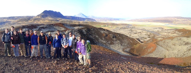
We moved from the farm and went to visit a crater called Gabrok. This was 173 meters above sea level and appeared to have been built by several episodes of eruptions based on the fact that multiple craters rings were observed. From this location, we noticed the spectacular geological features that were visible in all directions. There were several faults visibly offsetting basaltic layers, dykes that cut across layers of rocks, lava fields of different ages that surround the crater we were standing on, Roche Moutanees with large glacial grooves on top of them, and a meandering river that cuts through glacial sediments on the flat valley bottom. We used this opportunity to teach students about how to put observations together to reconstruct geological history of the area. It was one of the best locations for this, and it worked very well because they have seen a lot of geology in the past 10 days and this pulls their experience together in a meaningful way. What a great experience for them.
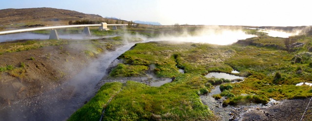
 The last stop for the day was Deildartunguhver geothermal field, which is one of the largest producing (180 L/second) geothermal field in the world. The temperature of the water that is springing out is more than boiling temperature, so there were warning signs all over reminding us to not touch the water. They are pumping hot water from here and transport nearly 75 km through pipelines to distant towns and rural areas for heating and other household purposes. They also generate about 62 MW electricity from this field. This is just one of the many!!!
Another day in heavens came to an end.
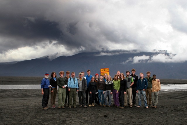
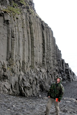
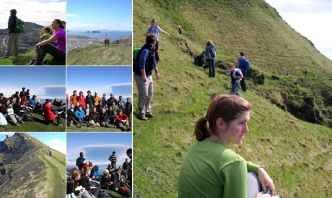
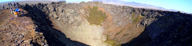
 This is our last day in Borgarnes town. We left from hostel at 8.30 AM and left for our first stop at Eldborg Crater. This is one of the most complete crater in Iceland that formed from low viscosity magma. It is mainly built up by layers of scoriacious (dark colored lava rock with lots of large gas bubbles) lava. Unlike most craters we have seen in the past, this was very steep – more than 150 ft tall from base to the rim, and perfectly symmetric. Nearest parking access was 3 km from this, so it was pretty intense walking through lava fields to get to the crater and hike up to the top of it through steep sides. It was well worth it.
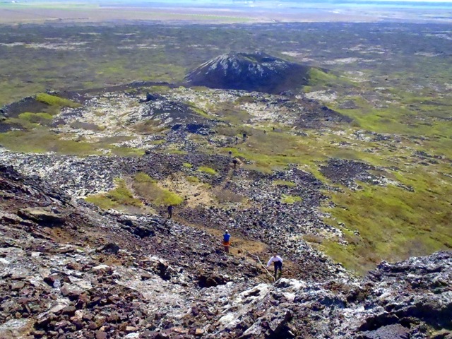
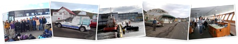
 What a place this is. The 6 km hike wiped us all out and we spent the reminder of the bus journey half-asleep. Suddenly the bus slowed down and we woke up to what looked like a toll booth. After passing through it, we came across the tunnel that goes below the deep fjord. It was 6 km long tunnel and it was amazing how well kept it was. Completely dry, clean, and well lit. Such an engineering feat to have been able to do it.