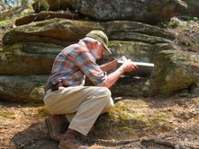
John M. Garihan just published the Geologic map of the Landrum 7.5-minute quadrangle with the support of the SC Geologic Survey. It is available to the public through the SCDNR website, along with 12 other 1:24,000 scale maps mapped by J. Gariha n and W. A. Ranson in upstate South Carolina. These GQM and MS series maps can be viewed and obtained from:
http://www.dnr.sc.gov/geology/publications.htm
Click on General Geologic Map Series. The Tigerville and Saluda quadrangle geologic maps are in their final preparation phases, to be available this fall or next spring. These maps are used by the public for recreational and hiking purposes, for the general interest of scientifically literate individuals, and for planning purposes by city planners, among many other uses like siting water wells etc.