Canada on Fire, Literally!

The boreal forests of northern Canada have evolved to burn. These forests are dominated by black spruce, a type of evergreen that is not just tolerant of fire but dependent on it.  Black spruce has waxy, resinous needles adapted to ignite during lightning storms and burn vigorously. The forests thrive if they burn every century or so because fires open the canopy up to light, stimulate new growth, and help maintain biodiversity. Fires also melt away the waxy coating on cones of black spruces allowing them to deposit seeds uniquely designed to thrive in charred, acidic soils. But Canada’s black spruce boreal forests have been burning more frequently in recent decades, putting even these fire-loving forests under strain.

The VIIRS (Visible Infrared Imaging Radiometer Suite) on the NOAA-20 satellite captured this image of smoke streaming throughout the region on August 11, 2024, the sensor detected nearly 100 active fires burning in the Northwest Territories, according to data posted by the territory’s government. The Canadian government, including the Northwest Territories, uses hotspot data from the Fire Information for Resource Management System (FIRMS), a fire monitoring system developed by NASA, to help detect and track wildfires.
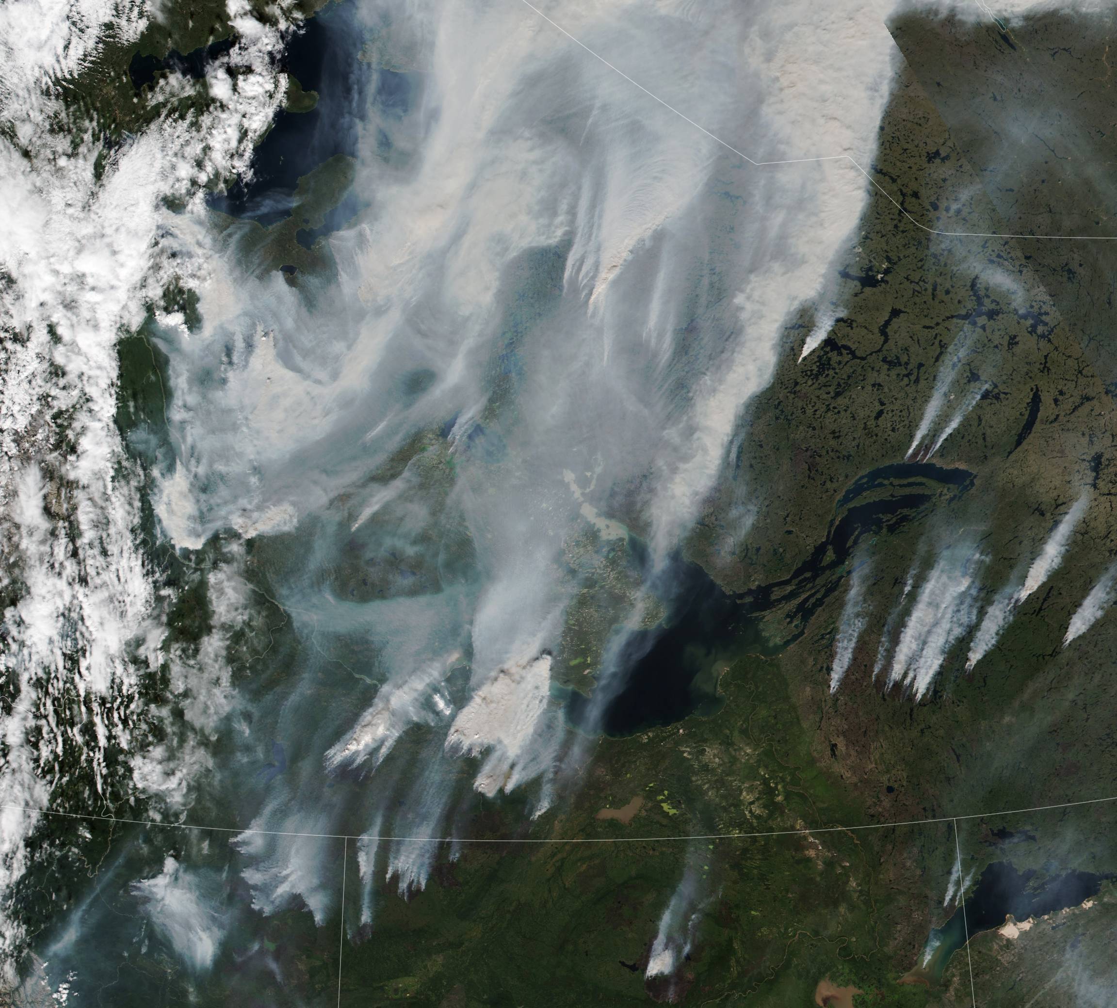
Wildfire in the boreal forests in northerly Canadian territory

For full story, check here!

Census Atlas of the United States

This is a good resource for a lot of us who use census data in our classes or in our research.  Whole atlas is available in digital format (PDF).  The description as shown on the census website is below.

“We are pleased to present the complete content, in PDF format, of the recently published Census Atlas of the United States, the first comprehensive atlas of population and housing produced by the Census Bureau since the 1920s. The Census Atlas is a large-format publication about 300 pages long and containing almost 800 maps. Data from decennial censuses prior to 2000 support nearly 150 maps and figures, providing context and an historical perspective for many of the topics presented.

A variety of topics are covered in the Census Atlas, ranging from language and ancestry characteristics to housing patterns and the geographic distribution of the population. A majority of the maps in the Census Atlas present data at the county level, but data also are sometimes mapped by state, census tract (for largest cities and metropolitan areas), and for selected American Indian reservations. The book is modern, colorful, and includes a variety of map styles and data symbolization techniques. ”

Click the map to go to the link or copy and paste the url below:

http://www.census.gov/population/www/cen2000/censusatlas/

Windows Live Writer – simplest blog writer.

I have been using windows live writer for few months and I love it.  Before I discovered this program, I was using the web based WordPress blog editor.  It was terribly slow to respond and you have to be online to work on it.  Since most of us would be working on these blog entries in multiple sitting, it is nice to have an “offline” blog editor.  Windows Live Writer allows one to work on your post off line and then when it is ready, then upload it to the blog site.  Coolest thing is that it takes care of all the formatting to match your blog site.  I love using Windows Live Writer, and I am sure you will too.Here is a brief video some one has put together that describes this program and it’s capabilities.Posted by: Suresh Muthukrishnan

GIS Jobs from around the world by Location

The GIS Jobs Clearinghouse website www.gjc.org shows list of available jobs.  The unique thing about this is they appropriately use GIS to show where exactly the job is located.  They use Google Maps API to show the locations of the job. 

Now find where you want to live and then look for a job in that location.  Click on the map to get to the website.

Posted by: Suresh Muthukrishnan