Canada on Fire, Literally!

The boreal forests of northern Canada have evolved to burn. These forests are dominated by black spruce, a type of evergreen that is not just tolerant of fire but dependent on it.  Black spruce has waxy, resinous needles adapted to ignite during lightning storms and burn vigorously. The forests thrive if they burn every century or so because fires open the canopy up to light, stimulate new growth, and help maintain biodiversity. Fires also melt away the waxy coating on cones of black spruces allowing them to deposit seeds uniquely designed to thrive in charred, acidic soils. But Canada’s black spruce boreal forests have been burning more frequently in recent decades, putting even these fire-loving forests under strain.

The VIIRS (Visible Infrared Imaging Radiometer Suite) on the NOAA-20 satellite captured this image of smoke streaming throughout the region on August 11, 2024, the sensor detected nearly 100 active fires burning in the Northwest Territories, according to data posted by the territory’s government. The Canadian government, including the Northwest Territories, uses hotspot data from the Fire Information for Resource Management System (FIRMS), a fire monitoring system developed by NASA, to help detect and track wildfires.
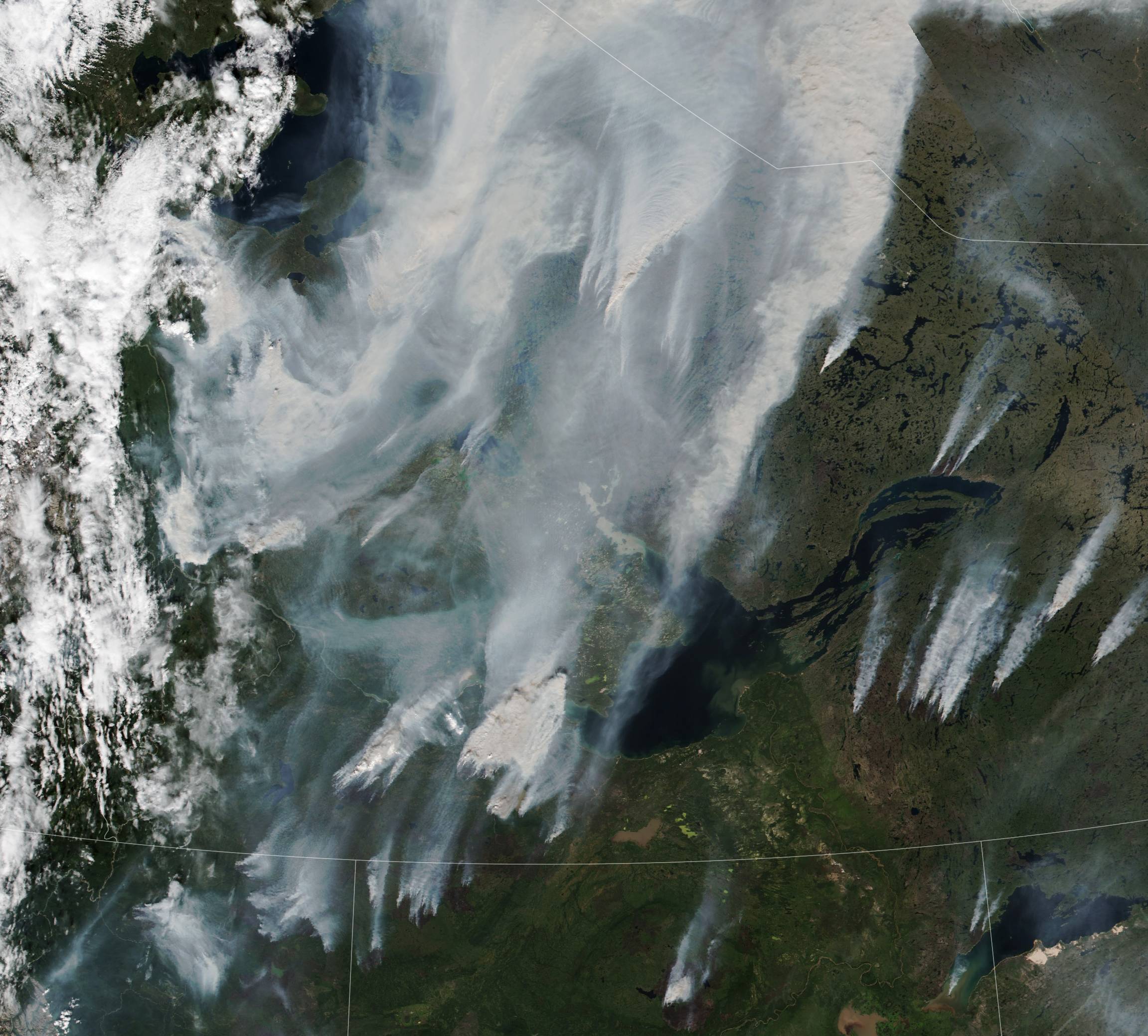
Wildfire in the boreal forests in northerly Canadian territory

For full story, check here!

Algal Bloom in South Atlantic

A Dark Bloom in the South Atlantic

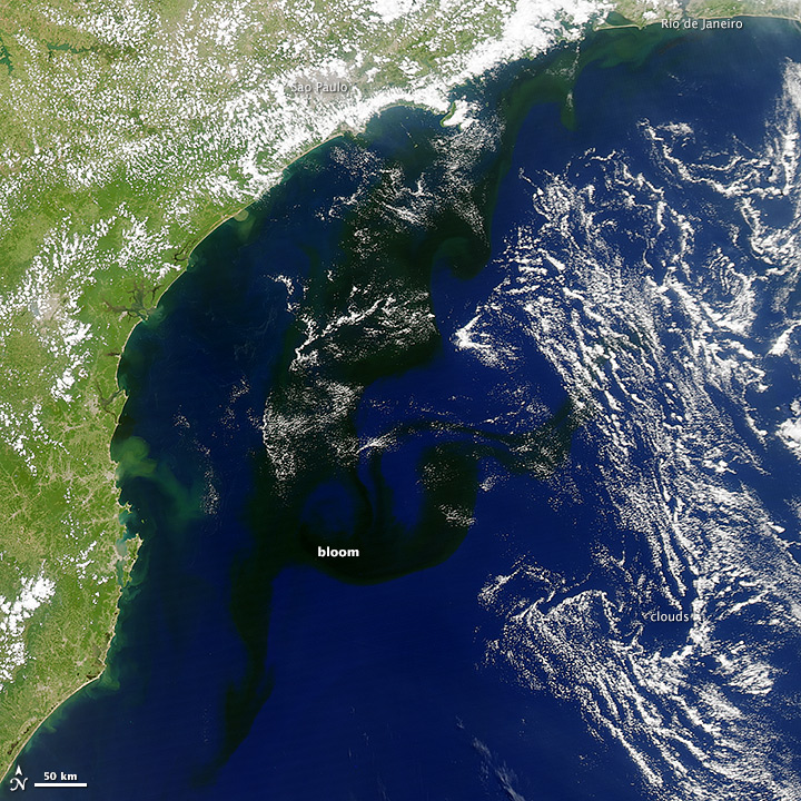
On January 19, 2014, the Moderate Resolution Imaging Spectroradiometer (MODIS) on NASA’s Aquasatellite captured this image of a bloom of microscopic organisms off the southeastern coast of Brazil. Note how the waters of the South Atlantic are darkened in patches stretching as much as 800 kilometers (500 miles) from south to northeast across the continental shelf. In the image, the puffy strands of white over the sea and inland are clouds.

Biologists working in the area have identified the bloom as Myrionecta rubra (previously known asMesodinium rubrum), a fast-swimming ciliate protist. Though it is not a true phytoplankter, it is an autotroph; that is, it makes its own food. Myrionecta fuels itself by photosynthesis, but it does so byingesting chloroplasts (chlorophyll-bearing plastids) from other algae. Aside from threatening the microscopic algae it consumes, Myrionecta rubra is not known to be toxic to other marine life or humans.

Viewed close-up, these blooms have a deep red color. But this bloom appears nearly black in the satellite image because of how the ocean scatters and absorbs sunlight. Myrionecta rubra blooms tend to float a meter or two below the water surface, so whatever photons of red light they are reflecting are likely being absorbed or scattered on their way back to the surface.

Closer to shore—look near Rio de Janeiro and Sao Paolo—the water has a green tint, perhaps signs of a different bloom of phytoplankton or of sediments stirred up by recent flooding in the region.


Global Warming Mapped by NASA Satellites

Long term climate study by NASA using data acquired through a variety of sources including weather stations across the world, ships, and many satellites show an increasingly warming trend in the world over the last 30 year period.  The satellite images below show the temperature anomalies.  This shows that irrespective of what is causing this trend, the world is getting warming.

Global Warming Mapped

Color bar for Global Warming Mapped

Read the full information on NASA website: http://earthobservatory.nasa.gov/IOTD/view.php?id=47628&src=eoa-iotd