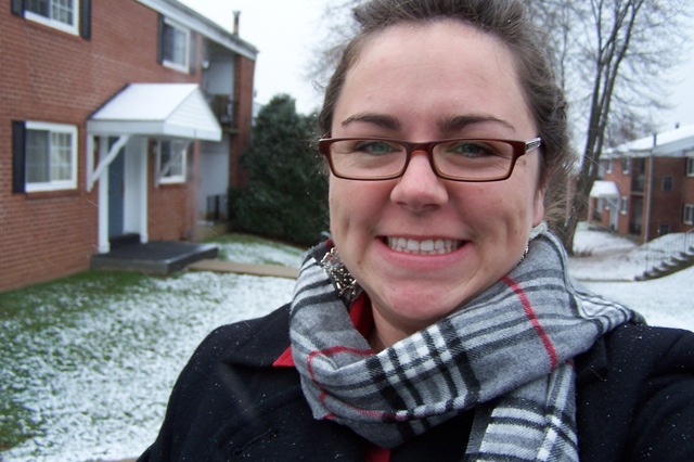
Well, it’s been over a year since I left the "Furman Bubble" and I certainly miss it! I
am working as a Graduate Environmental Scientist for URS Corporation in the Philadelphia suburbs. I currently split my time between field work and office work, which I love. A typical day in the office may include anything from writing remedial action reports to the State, drawing contour maps, making graphs and figures, and logging soil characteristics. So far, my field work has included a plethora of groundwater sampling events, using GeoProbe direct push, RotoSonic Drilling, oily sludge recovery, various land restoration activities (i.e. rebuilding vegetation), and cone penetration testing. For me, the field work is much more exciting and feels less like "work" than being in the office.
I have used a lot more from my undergraduate education at Furman than I ever imagined! My professors and diverse course work sent me off into the Environmental Industry very well prepared. The experience of writing an undergraduate thesis was particularly helpful in showing my Project Managers and other colleagues that I knew how to write scientifically. Many young people have limited writing skills, which ultimately limits the work they can perform. One thing I might suggest to Furman seniors and/or recent graduates looking for jobs in the industry is FIELD CAMP. Field camp isn’t just for those going to graduate school. It may cost you up front, but it will pay off if you plan to work as a geologist/environmental scientist. Many real-world projects include tasks like hiking and mapping, interpreting geologic structures, using a Brunton, etc. If you are waiting to hear from employers about jobs and are looking for something to do – go to field camp! It will look great on your resume and boost your confidence when you eventually work on those types of projects. The first year out of college flew by, as everyone said it would, but I am very satisfied with the start of my career!
– SunnyRae Granger
Month: September 2009
Dr. Garihan publishes Geologic Map of Landrum Quad
John M. Garihan just published the Geologic map of the Landrum 7.5-minute quadrangle with the support of the SC Geologic Survey. It is available to the public through the SCDNR website, along with 12 other 1:24,000 scale maps mapped by J. Gariha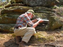 n and W. A. Ranson in upstate South Carolina. These GQM and MS series maps can be viewed and obtained from:
http://www.dnr.sc.gov/geology/publications.htm
Click on General Geologic Map Series. The Tigerville and Saluda quadrangle geologic maps are in their final preparation phases, to be available this fall or next spring. These maps are used by the public for recreational and hiking purposes, for the general interest of scientifically literate individuals, and for planning purposes by city planners, among many other uses like siting water wells etc.